球球各位点个star🌟吧🙏 
Do you like the project? Please star🌟 us on GitHub to support the project! Thank you very much for your support!
🚀 23/01/2025: Support the SOTA LIVO System: Fast-LIVO2 !
🚀 01/09/2024: The author came to the HKU MaRS Lab for postgraduate study under supervised by Prof. Fu Zhang and continued his journey in robotics and SLAM
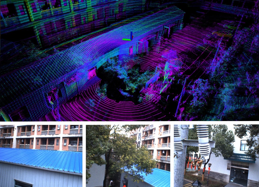
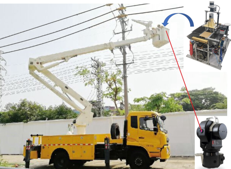
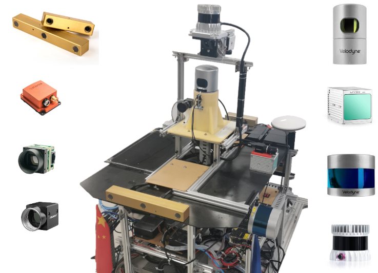
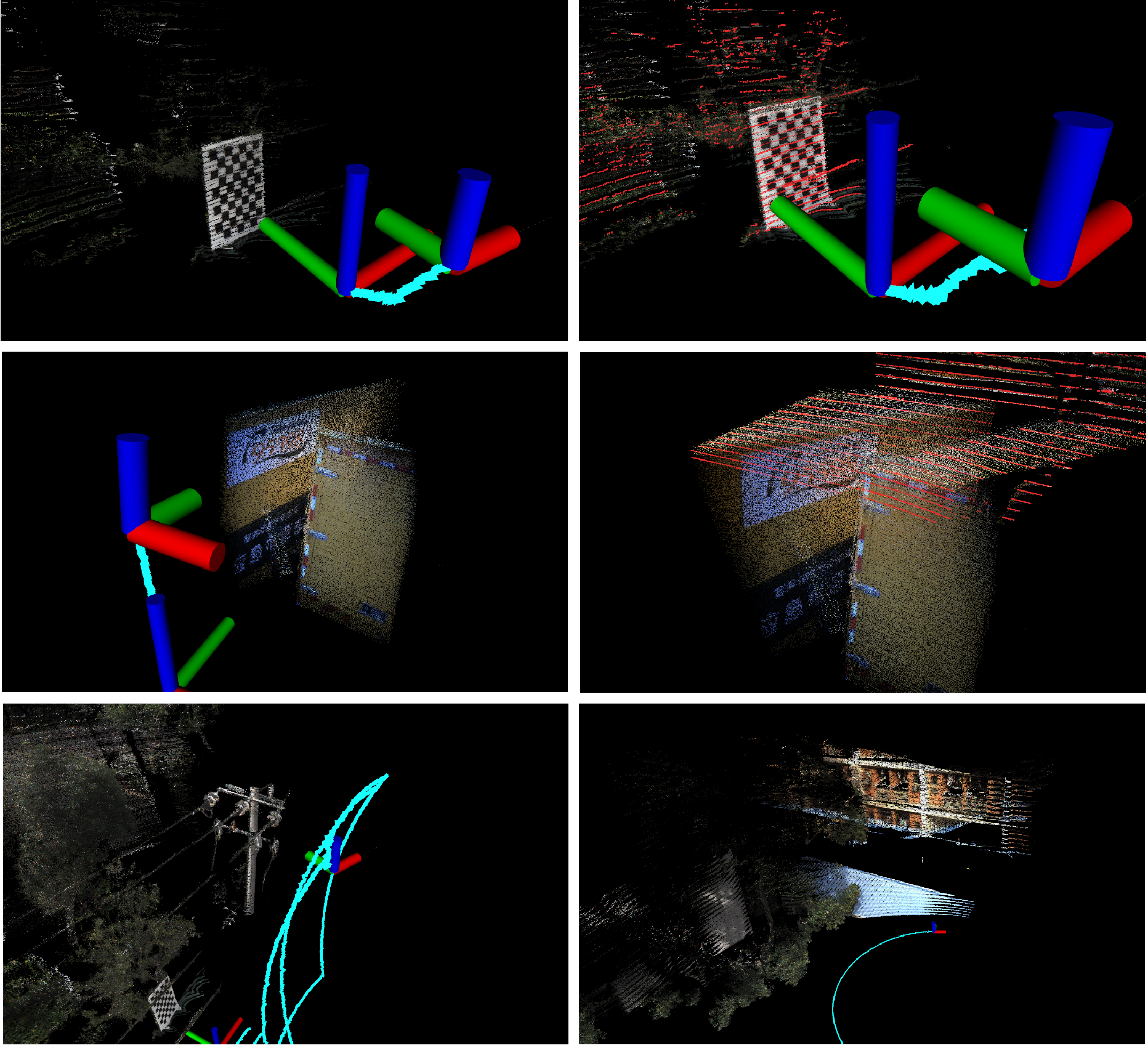
 |
 |